Il valore dei dati applicati a scenari di protezione civile per gestire calamità - Data Science for Industrial and Societal Applications Research ...
←
→
Trascrizione del contenuto della pagina
Se il tuo browser non visualizza correttamente la pagina, ti preghiamo di leggere il contenuto della pagina quaggiù
LINKSFOUNDATION.COM

     Il valore dei dati applicati a scenari
     di protezione civile per gestire calamità
     Data Science for Industrial and Societal Applications Research Area

                  FABRIZIO DOMINICI – HEAD OF DATA SCIENCE AREA
                  30 GIUGNO 2021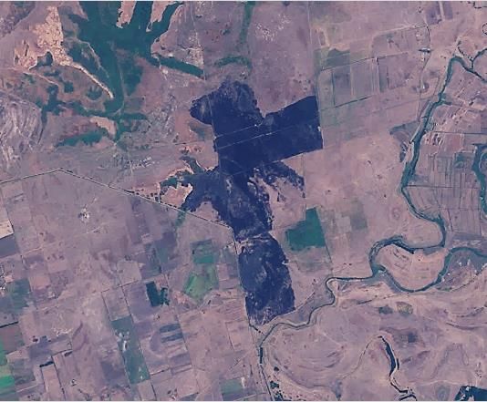
Negli ultimi 5 anni i disastri causati da eventi naturali
  estremi innescati dai cambiamenti climatici hanno
causato perdite per più di 350 $miliardi/anno nel mondo
Il nostro percorso di ricerca per ottenere soluzioni modulari e di
    impatto basate sullo sfruttamento di dati e AI
    Aumentare la resilienza del territorio vuol dire sfruttare le informazioni lavorando prima, durante e dopo i disastri

                                                     ALCUNI PASSI DA COMPIERE
    • Analizzare il proprio target e le soluzioni esistenti a disposizione
    • Disegnare un processo finalizzato al raggiungimento degli obiettivi prefissati
    • Valutare gli strumenti disponibili e chi li può operare nel contesto di riferimento in modo coordinato (un emergenza
      provocata da disastri naturali non è quasi mai un problema di un singolo comune!)
    • Prototipare gli strumenti non disponibili e valutarne l’integrabilità con le soluzioni esistenti
     TORINO                                                                                                                 linksfoundation.com
3    16 LUGLIO 2021
                                                                                                                            COPYRIGHT ©2021 LINKS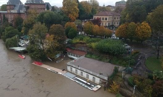
Sorgenti Dati

                 EARTH                UAV and IOT          FORECAST           HUMAN
              OBSERVATIONS             SENSORS              MODELS          GENERATED

             • Big volumes         • Needs Humans to   • Uncertainty       • Noisy

             • Limited spatial       generate data                         • Fake news
               resolution          • Local coverage                        • Unstructured

             • Global coverage
                                   • High spatial      • Availability      • Direct field data
             • No human need for
                                     resolution        • Well structured   • Multiple media
               generation
                                                                           • High temporal
                                                                             resolution

    TORINO                                                                                       linksfoundation.com
4                                                                                                COPYRIGHT ©2021 LINKS
La centralità dei dati nel processo di aumento della resilienza
    L’innovazione avviene facendo leva su dati eterogenei e su tecniche avanzate di AI per aumentare un awarness e forecasting
                                                                        + RESILIENCE

          CYBER TECHNOLOGIES &                                                                                       CITIZEN AWARENESS &
           REMOTE DATA SOURCES                                                                                       ENGAGEMENT

                            EARTH                                                                                    MOBILE APPS &
                       OBSERVATION                                                                                   CHATBOTS
                                                                              CONTROL
                         AUGMENTED                                             ROOM
                            REALITY
                                                                                                                     SOCIAL MEDIA
                                                                IN-FIELD
                         WEARABLES                                                       ACTIVE
                                                                AGENTS
                                                                               AI       CITIZENS
                                                                                                                     GAMIFICATION
                          AERIAL- UAV
                                      Data Fusion                                             Validation & Knowledge Extraction

                              DISASTER RISK MANAGEMENT INFORMATION (Risk, Delineation, Forecasting…)
    DOMAINS                       COMPETENCES                                           FRAMEWORK/PROJECTS                           FLOODIS               I-REACT
    • Natural hazards             Unsupervised Machine Learning – Deep                  • FP7: Snowball, FLOODIS
                                  Learning, Decision Trees, SVM, clustering                                                          FASTER
    • Risk analysis                                                                     • H2020: I-REACT, SHELTER,
    • TORINO
       Emergency Management       NLP, word embeddings                                    FASTER, SAFERS                                       linksfoundation.com
5                                                                                                                                              COPYRIGHT ©2021 LINKS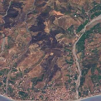
Human Generated Data
    Dati proveninenti da social media usati per rilevare eventi e combinati con…

      CLASSIFICATION: NLP PLUS
         MACHINE LEARNING

    Topic detection
    machine learning - clustering
    Informativeness
    binary classifier
    Panic
    sentiment analysis
    Information type
    multiclass classifier
    Named Entity Recognition
    Rule-based                                    AMATRICE EARTHQUAKE 24 AUGUST 2016

     TORINO                                                                            linksfoundation.com
6    16 LUGLIO 2021
                                                                                       COPYRIGHT ©2021 LINKS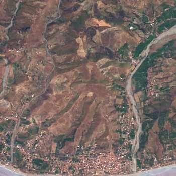
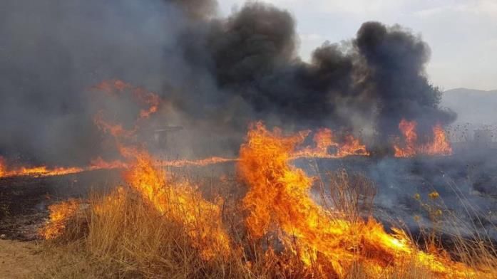
Mappatura aree bruciate

                        PRIMA                            DOPO   AREA BRUCIATA

                     Area not burned

                           Montebello Jonico, Calabria, Italy   #deeplearning

    TORINO                                                                  linksfoundation.com
7   16 LUGLIO 2021
                                                                            COPYRIGHT ©2021 LINKS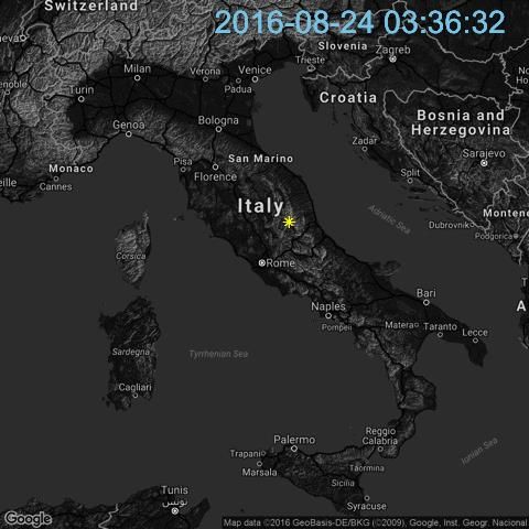
Mappature aree bruciate da satellite con AI
    Usando una combinazione di Sentinel-1 e Sentilel-2 Using Sentinel-2 per stimare la severità delle aree bruciate con AI

    • Data sources
         • Copernicus Emergency Management System (manually validated masks)
         • Sentinel-2: 12 bands, 10m/pixel, 5-6 days revisit time

    1. Unsupervised ML
         • Before and after-wildfire pictures, Image processing and Self-Organising
           Maps (SOM)
         • precision: 0.81 - recall: 0.66 - F1 score: 0.70

    2. Supervised delineation
         • After-wildfire only pictures, Deep Learning approach (U-Net)
         • precision: 0.89 - recall: 0.78 - F1 score: 0.81

    3. Supervised severity estimation
         • After-wildfire only pictures, DL approach (Double-Step U-Net)
         • precision: 0.80 - recall: 0.97 - F1 score: 0.88

         Burned Area Delineation - ISCRAM (2020)
         Severity Estimation - Journal, MDPI (2020)
    DOMAINS                      COMPETENCES                                  RELETED PROJECTS
    • Climate Change             Unsupervised Machine Learning, clustering,   • FASTER
    • Natural Hazards            Deep Learning, Computer Vision               • SHELTER
    • TORINO
       Emergency Management                                                   • SAFERS                              linksfoundation.com
8                                                                                                                   COPYRIGHT ©2021 LINKS
                                                                                                                                            2020
Delineating Flooded Areas from Satellite with AI
    Using Sentinel-1 SAR data and Sentinel 2 images to delineate flooded areas through different AI model iterations

                                                               • Data sources
                                                                         • Copernicus EMS Sentinel-1: 2 bands, 30m/pixel, 5-6 days revisit time
                                                                         • Sen1Floods11 dataset composed of Sentinel-1 images of flooded areas

                                                               1. Supervised delineation model – v1.0
                                                                         • U-Net model trained on 48 images subset, with k-fold technique. Each fold
                                                                           consisted of 40 training images and 8 test images.
                                                                         • precision: 0.68 - recall: 0.83 - F1 score: 0.74

                                                               2. Supervised delineation model – v1.1
                                                                         • U-Net model trained on an enlarged set of 196 images with a 0.75/0.25
                                                                           split. Stronger data augmentation.
                                                                         • precision: 0.67 - recall: 0.83 - F1 score: 0.75

                                                               3. Supervised delineation model – v2.0
                                                                         • U-Net model trained on Sen1Floods11 (available since Nov. 2020), 446
                                                                           hand labeled images with a 0.75/0.25 split.
                                                                         • precision: 0.70 - recall: 0.50 - F1 score: 0.58

    DOMAINS                   COMPETENCES                                          RELETED PROJECTS
    • Climate Change          Supervised Machine Learning, clustering,             • FASTER
    • Natural Hazards         Deep Learning, Computer Vision                       • SHELTER
    • TORINO
       Emergency Management                                                        • SAFERS                                              linksfoundation.com
9                                                                                                                                        COPYRIGHT ©2021 LINKS
                                                                                                                                                                 2020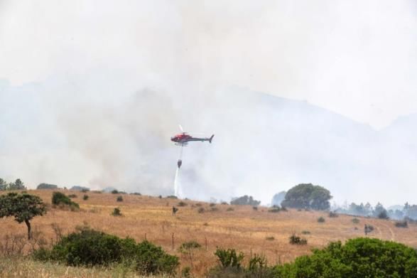
DECISORI                                   SISTEMI DATA DRIVEN

              DECISION
              SUPPORT SYSTEM
              Help Decision makers in monitoring
              and quickly take decisions

              DATA                                                 Artificial Intelligence
              FUSION
              + organization                                       Variety / Volume of data
              + integration
              + machine learning for information
              filtering and pattern detection

              SOURCES
              Extract value from existing public
                                                      Earth
              data repositories                                      IoT          Models      Human generated
                                                   observation /
     TORINO
10
                                                      UAV                                         linksfoundation.com
                                                                                                  COPYRIGHT ©2021 LINKS
ALCUNE LEZIONI INTERCETTATE IN
QUESTI ANNI
Sfruttare asset europei (es.
Copernicus) e strumenti esistenti in
una logica complementare sfruttando
standard
Investire sulla multidisciplinarità e su
tecnologie di frontiera come l’AI con
uno sguardo alla manutenibilità delle
soluzioni
Nel disegnare un prototipo
considerare la sostenibilità di gestione
e uso delle soluzioni
VITTORIO DI TOMASO
1Fabrizio Dominici fabrizio.dominici@linksfoundation.com Via Pier Carlo Boggio 61 | 10138 Torino (Italia) +39 3316557125 info@linksfoundation.com linksfoundation.com
Puoi anche leggere